These illustrate the features of this newly charted land, including the native Indians and European exploratory and fishing fleets. Nova Scotia and Newfoundland are both represented in a very early cartographic form.
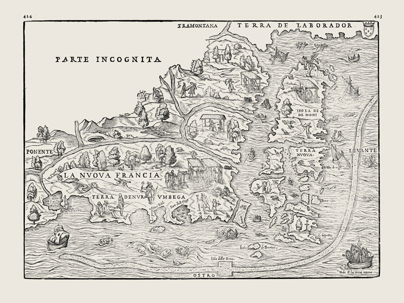
With limited information available to the mapmaker, this map is necessarily a combination of recorded fact and guesswork, and sometimes even fantasy.
To the north of Newfoundland we find the mythical “Isola de Demoni” (Isle of the Demons) thought to be home to vicious animals and beasts.

Thank You to Maps & More!
Special thanks to Farhad Vladi of Maps & More for providing this digital representation for display on ViewPoint.
For maps and travel enthusiasts, visit Maps & More.
The store is located at 1601 Lower Water Street, Halifax.